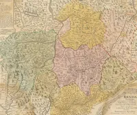
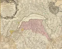
[Atlas novus Reipublicae Helveticae] : [XX. Mappis compositus]
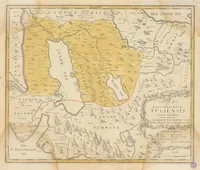
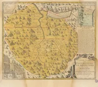
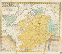
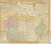
An eighteenth-century atlas of Switzerland, compiled by Gabriel Walser and Heinrich Peyer and issued in 1769 by the Homann heirs in Nuremberg for a learned and mapping-minded readership. Its hand-coloured copperplate maps show cantons, lakes and mountain districts in pale washes of yellow, pink, green and blue with decorative cartouches, and a designer can take from them the period palette, engraved lettering and ornamented title frames.
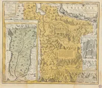
![Picture 1 of 7 from [Atlas novus Reipublicae Helveticae] : [XX. Mappis compositus] (1769), leaf 12](https://img.insideoutlibrary.com/img/200/erara-10268073-12-1.webp)
![Picture 2 of 7 from [Atlas novus Reipublicae Helveticae] : [XX. Mappis compositus] (1769), leaf 21](https://img.insideoutlibrary.com/img/200/erara-10268073-21-1.webp)
![Picture 3 of 7 from [Atlas novus Reipublicae Helveticae] : [XX. Mappis compositus] (1769), leaf 24](https://img.insideoutlibrary.com/img/200/erara-10268073-24-1.webp)
![Picture 4 of 7 from [Atlas novus Reipublicae Helveticae] : [XX. Mappis compositus] (1769), leaf 30](https://img.insideoutlibrary.com/img/200/erara-10268073-30-1.webp)
![Picture 5 of 7 from [Atlas novus Reipublicae Helveticae] : [XX. Mappis compositus] (1769), leaf 45](https://img.insideoutlibrary.com/img/200/erara-10268073-45-1.webp)
![Picture 6 of 7 from [Atlas novus Reipublicae Helveticae] : [XX. Mappis compositus] (1769), leaf 48](https://img.insideoutlibrary.com/img/200/erara-10268073-48-1.webp)
![Picture 7 of 7 from [Atlas novus Reipublicae Helveticae] : [XX. Mappis compositus] (1769), leaf 54](https://img.insideoutlibrary.com/img/200/erara-10268073-54-1.webp)