Aerial navigation by dead reckoning
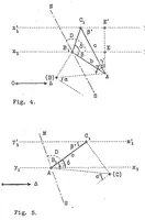
A technical diagram from a 1922 NASA Technical Reports Server record on aerial navigation by dead reckoning, a document of unknown author rendered as line drawings of geometric navigation problems. Its two figures, labelled Fig. 4 and Fig. 5, use dashed guide lines, Greek letter angles, and vectors to show how a pilot plots a course through wind drift. A designer might borrow the clean vector-diagram style, the labelled angle notation, and the schematic compass-bearing layout for technical infographics.