Air transport
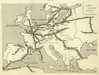
A 1924 French-language map titled L'Europe Aérienne en 1923-1924, published in a NASA technical reports collection, showing air routes across Europe for a general aviation audience. The picture is a black and white line map with dark route lines radiating from cities over stippled seas and hatched land, with labels for Atlantique, Mer du Nord, Méditerranée and Mer Noire. A designer could take its clean route-network diagram style, with heavy lines linking nodes over a textured base, as a model for transport or infographic layouts.