Latecoere Air Lines
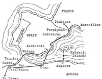
Latecoere Air Lines is a 1925 aviation record from the NASA Technical Reports Server, compiled for technical and historical readers rather than a general audience. The one picture is a hand-drawn route map of southwestern Europe and northwestern Africa, with lines tracing air routes between French, Spanish, Portuguese and North African cities. A designer could take from it the schematic style of a route map: sparse linework, handwritten place names, and a dashed line running across the sea to show a flight path.