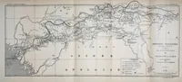
De Conakry au Niger
A late nineteenth-century French geographic survey map published in Paris in 1899 by the Société de géographie, recording the route of the Mission Salesses, a railway survey led by E. Salesses, from Conakry toward the Niger. The map is a plain engraved line drawing with a title block, legend and a dense network of routes, rivers and place names. A designer could take its clean hand-drawn cartographic linework, boxed title cartouche and legend layout as a model for technical diagrams or route maps.