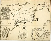
A description of the island of Jamaica; with the other isles and territories in America, to which the English are related, viz. Barbadoes, St. Christophers, Nievis or Mevis, Antego, St. Vincent, Dominica, Montserrat, Anguilla, Barbada, Bermudes, Carolina, Virginia, Maryland, New-York, New England, New-Foundland
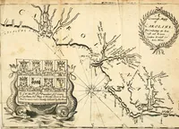
A 1672 London book by Richard Blome, a compiler of colonial geography, printed by T. Milbourn and sold by J. Williams, describing Jamaica and the English territories in the Americas for readers at home. Its pictures are small woodcut headpieces and engraved maps with compass roses, heraldic cartouches and coastlines, useful to a designer for border ornament, map cartouches and antique cartography.