General information as to the East Africa Protectorate
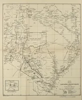
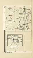
This 1919 London government handbook from the Oversea Settlement Office describes the British East Africa Protectorate for prospective settlers and emigrants. Its two pictures are folding-style maps: a small inset plan of Mombasa island with a larger map of the protectorate showing the Uganda Railway, lakes, and tribal areas. A designer could take the crisp hand-drawn cartographic linework, lettering, and the inset-on-main-map layout as a model for technical or colonial-era reference graphics.