Voyage de la Propontide et du Pont-Euxin: avec la carte générale de ces deux mers ...
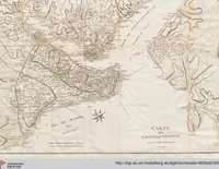
A 1800 travel account of the Sea of Marmara and Black Sea by Jean Baptiste LeChevalier, printed for readers of archaeology and topography, shows a detailed copperplate map of Constantinople with its harbour and the Marmara coast. The scan shows engraved coastlines, hatched land, a compass rose and a titled cartouche, offering a designer a sepia antique cartographic texture with fine hand-drawn contour lines and lettering.