L'État indépendant du Congo; historique, géographie physique, ethnographie, situation économique, organisation politique
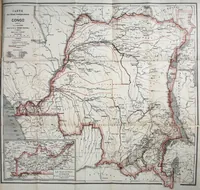
A scholarly history and survey of the Congo Free State by Alphonse-Jules Wauters, published in Brussels by Librairie Falk fils in 1899, aimed at readers interested in Belgian colonial administration. The picture is a folding colour-tinted map of the Congo basin with a red-outlined territory, river network, and an inset map of the Belgian Congo at lower left, useful to a designer for cartographic linework, boundary-line treatments, and period typography in the title cartouche.