Map maneuvers and tactical rides
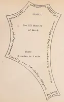
Map maneuvers and tactical rides is a 1910 military training manual by Farrand Sayre, printed by the Army Service Schools Press at Fort Leavenworth, Kansas, for army officer students. The single plate shows a star-shaped distance diagram labelled with march times and ground distances for cavalry, field artillery, mounted messengers and infantry, a practical reference for planning movement on a tactical map. A designer might take its plain typeset labels, curved text following the outline, and the radiating geometric shape as a clean, functional diagram motif.