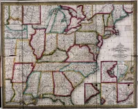
Mitchell's Traveller's guide through the United States : containing the principal cities, towns, &c. alphabetically arranged; together with the stage, steam-boat, canal, and rail-road routes, with the distances, in miles, from place to place. : illustrated by an accurate map of the United States
A traveller's guide and route book published in Philadelphia in 1836 by Mitchell & Hinman, compiled by S. Augustus Mitchell for travellers across the United States, listing cities, towns and stage, steamboat, canal and rail-road routes with mileages. Its single picture is a folding map of the eastern and central United States, engraved by D. Haines and J. H. Young, with states outlined in hand colour and a decorative title cartouche. A designer could take its boundary-colour blocking, dense place-name lettering and ornamental cartouche as a model for period cartographic layouts.