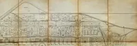
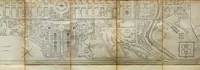
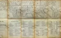
Offizieller Plan der Weltausstellung 1873, Wien
An official folding plan of the 1873 Vienna World Exhibition, published in Stuttgart by Eduard Hallberger for visitors to the fair. The three frames show the grounds as a long horizontal map with a formal palace garden at left, rectilinear pavilion blocks in the centre and a winding river or canal at right, drawn in fine line on aged paper with a printed legend and index columns below in the third view. A designer could take the fine hatched linework, the grid of building footprints and the tidy printed key typography as reference for technical plan layouts.