Topographia Helvetiæ, Rhætiæ et Valesiæ : das ist, Beschreibung vnnd eygentliche Abbildung der vornemsten Stätte vnd Plätze in der hochlöblichen Eydgnossschafft, Graubündten, Wallis, vnd etlicher zugewandten Orthen
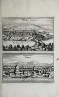
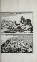
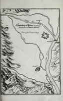
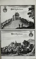
Topographia Helvetiæ, Rhætiæ et Valesiæ is a 1654 topographical book by Martin Zeiller, published in Frankfurt am Main by the Merian heirs, describing towns, castles and places of Switzerland, Graubünden and Valais for German readers. Its pictures are paired copperplate views of castles, hilltop towns and a fortified river map, drawn in fine crosshatched line with small heraldic shields, a useful reference for historic European landscape and architectural line work.